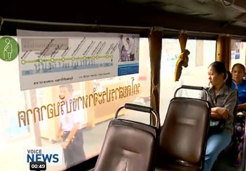
Finally Bangkok buses have route maps inside
This is good news, we will finally have route maps displayed in public buses in Bangkok. It will greatly facilitate the lives of tourists tempted by this means of transport and even Thai for whom it was difficult to know which bus to take as they mainly know the lines they are used to take.

With more than 6,000 buses in circulation on nearly 400 lines in the “Great Bangkok”, Bangkok bus network is a huge canvas in which it is difficult to find your way. The absence of a map was the main problem for commutters. No route map existed on bus stops or in the buses. Only maps could be purchased in book shops but were not always very clear. But that was before !

At the initiative of a 25 years old young man who has developed his own maps, Smart VC proposed to show route maps in Bangkok buses. He was inspired by what is done in Europe and especially in Paris and London as shown in this video (in Thai) about this revolution in transportation in Bangkok.
On this maps only the main stops have their names listed in Thai and English but there is small white points for each stop between these “big” stops. Interconnections with BTS (Bangkok Skytrain), MRT (subway) or Airport Link are also indicated on the maps. For the Chao Phraya Express, we do not have information, but it is probably also the case.
If you need to know which bus to take to go to the main places in Bangkok, you can use our bus search engine in Bangkok: http://www.thailandee.com/eng/transportation-thailand/find-bus-in-bangkok.php
For now, the new maps are in the buses themselves. I did not checked if all buses have them (I’m not in Bangkok). We hope to see them appear soon on bus stops too. Before, smartphone applications …
(thank you Marcie for this information !)


